

In 2012 the Borough of Mercersburg, in collaboration with Peters and Montgomery Townships, received a capacity-building grant valued at $100,000 to receive technical assistance toward the revitalization of Johnston’s Run, to achieve the long-term goal of health for our community and its citizens, Johnston’s Run watershed and the Chesapeake Bay. Since then MACWell recruited citizen scientists, volunteers who would monitor the stream. Partnering with The Alliance for Aquatic Resource Monitoring out of Dickinson College in Carlisle, several community members attended a training session at the Mercersburg Academy and began collecting valuable data, monitoring flow, temperature, conductivity, dissolved solids, nitrates, orthophosphates, and turbidity.
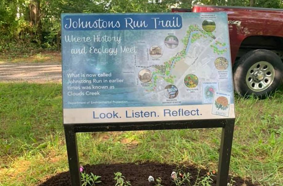
Simultaneously, MACWell began plans to bring their waterside trail to fruition. A DCNR Keystone Recreation, Park and Conservation Fund grant for $110,000.00, with additional private donations was used to create the Johnston Run Waterside Trail. The Franklin County Tourist bureau funded the historic signs which connect the trail to the history of the town, hence the designation of where history meets ecology; and benches were donated by community members and painted by students from James Buchanan High School.
Today the trail is actively used, yet the work continues. We invite you to join us and become a part of improving the health of our local waterways and the Chesapeake Bay!
Johnstons Run Watershed Management Plan
Based on the results of the watershed characterization, including desktop assessment, field assessments, and modeling – the following issues have been identified as primary factors in the watershed; basic restoration approaches are noted. The results of the studies were presented at a community workshop and will be posted in full online.
View Full Plan
Water Quality
Elevated nitrogen, phosphorus, sediment and bacteria. Sources include agriculture, livestock, urban runoff, and streambank erosion. These can be improved with both urban and agricultural Best Management Practicies (BMPs) addressing water quality.
Stream Erosion
72% of stream banks assessed have varying degrees of erosion. Erosion is addressed by streambank stabilization and stream restoration, stormwater BMPs to reduce peak flows, agricultural BMPs including livestock exclusion fencing and installation of riparian buffers.
Riparian Buffer
96% of the assessed channel is lacking adequate vegetative cover. Condition is addressed primarily through establishment of riparian buffers and proper management of streamside resources. Buffer management in agricultural settings should include livestock fencing to ensure success of planting efforts.

Specific Restoration Projects
Were identified for properties and landowners who participated in the Watershed Assessment. Many thanks to these landowners for their watershed stewardship and for their commitment to Revitalization of Johnstons Run. Additional recommendations can be developed for interested landowners. Johnstons Run Revitalization Council is working with Franklin County Conservation District to identify programs and grants that can help accomplish these projects.
Many Thanks
Many Thanks to our partners at Environmental Finance Center, KCI,Inc and National Park Services. With gratitude to National Fish and Wildlife Foundation for the generous capacity building grant. Thank you to Tuscarora Wildlife Education Program (TWEP) Center for an inspiring meeting space. Thank you to the tireless work of the Johnstons Run Revitalization Council – Laura Puckett (Project Director), Tammy Piper (Franklin County Conservation District), Liz McClintick (Environmental Educator TSD, TWEP advisory board), Liz George MD (President, MACWell), Tammy Oberholzer and Dawn Shiller (Mercersburg Borough), Bob Whitmore (MACWell)